I’ve been there and back again since my last dispatch. Of course it has been a whirlwind. Taking a week away is whittled down significantly with the travel part. It was great to have been in my Tuluksak home long enough to make a list of things that I needed to bring in. Now that I’m back here I’ve got some nice touches to make it feel more like home. Plus I have a bowl to eat things from. That is super helpful.
I spent most of the day with Ron Fortunado who is up here on a contract working on some interesting science/community/kid stuff. Give me a raincheck on giving all the details – it will feel too much like a report, and I’m feeling some guilt for not writing a proper one of those yet for the Powers That Be. What I like about what Ron is doing is he starts with the kids and the community: “What is something that you are concerned about and want to fix?” Here, there’s been concern about lead in the water after a few kids came back from their Bethel dentist with concerning blood work. Also, concern about rapidly eroding riverbanks creating sandbars in places there haven’t been sandbars before, cause grounded boats, and in one case in the neighboring village, deaths from some kids going too fast on the river. And then I added what I’ve heard from folks and the principal about the playground – first getting finished, and second if it is in the right place or not.
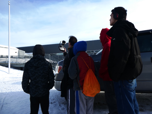
OK, so from this, here’s what he’s doing. He brought lead and pesticide testing kits for drinking water, and is working with the elementary teacher to teach the kids how to test water. Today we tested their classroom sink water (it was OK), but the hope is to work up to having them test their own household water. Data collected and presented to the community. With the eroding sandbars, he’s working with older kids to use a drone to do some measurements of the riverbank that will be geomapped. The students will keep track of the riverbank over time to measure the rate of erosion. They’ll also be able to use the drone to map current sandbars in the river for navigation this summer. And with the playground project, he worked with some students to program the drone to do an arial transect over the school area. The date is fed into a computer that will work overnight to create a three dimensional model of the school and the land around it. This can be used to start identifying where the high and low points of the property are, to help with locating and/or planning playground placement. Later we hope to look into what kind of design the kids would like to see, and also start to scope out some ways to help keeping the play area dry – all with the kids leading the charge.